 Ozikoro
Archive · Photograph
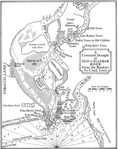
Map of the Cross River estuary c. 1820, Calabar River to NE. It was not known then that the Cross River was the larger, so the estuary was named after the Calabar. Photo credit; Wikipedia.
| Ref. | OZ-P-0743 |
|---|---|
| Type | Photograph · image/png |
| Credit | Wikipedia |
| Added | 23 December 2025 |
| Dimensions | 389 × 491 |
| Size | 177 KB |
| Rights | credit “Wikipedia” read from the item's own caption text, which says "Photo credit; Wikipedia.". Derived from the WordPress record, not established by a person: nobody has confirmed this. |
Used in
Reusing this
The rights recorded above are what the archive holds. Check them before reuse.